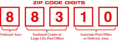
The postal code or ZIP code 64483 has Rosendale as common cities which are accepted by the US Post Office for this ZIP Code. The ZIP code may be located out ot the preferred city. Post office name is usually the city name for 64483. You are advised to add your ZIP code preffered or acceptable cities for mailing a letter etc. If you use an unacceptable city for your mailing you will end up getting delays.
Primary / Preferred City: Rosendale, MO

Extra Details of ZIP Code 64483
| ZIP Code | 64483 |
|---|---|
| Type | Standard |
| Common Cities | Rosendale |
| Country | Andrew County |
| Area Code (s) | 816 |
| Population | 709 |
| Population Density | 19 people per sq mi |
| Housing Units | 298 |
| Median Home Value | $108,700 |
| Land Area | 36.99 sq mi |
| Water Area | 0.2 sq mi |
| Occupied Housing Units | 259 |
| Median Household Income | $57,237 |
Primary and High Schools in ZIP Code 64483
The ZIP Code 64483 falls in the North Andrew County. R-VI School District. The following list of public and private schools consists of 3 high and elementary schools that have mailing address in 64483 ZIP code.
North Andrew Middle School
9120 Hwy 48
Rosendale, MO 64483
Grade Level: Middle/Elementary
District: North Andrew County. R-VI School District
North Andrew Elementary
9120 Hwy 48
Rosendale, MO 64483
Grade Level: Primary/Elementary
District: North Andrew County. R-VI School District
North Andrew High School
9120 Hwy 48
Rosendale, MO 64483
Grade Level: High/Secondary
District: North Andrew County. R-VI School District
Find out all Missouri ZIP code list. You can find out all United States Postal Code source USPS.